Police Precinct 10
Crash Narratives
Police Precinct 10: Traffic Crash Statistics
Crash Counter for Precinct 10 264 crashes • 1 deaths
About these crash totals
Counts come from NYC police crash reports (NYPD Motor Vehicle Collisions on NYC Open Data). We sum all crashes, injuries, and deaths for this area across the selected time window shown on the card. Injury severity follows DOT's KABCO definitions mapped from the NYPD Person table (injury status, injury type, and injury location).
- Crashes: number of police‑reported collisions (all road users).
- All injuries: people with any reported injury (KABCO A/B/C or generic "injured").
- Moderate / Serious: suspected minor + suspected serious injuries (KABCO B + A).
- Deaths: killed or apparent death reported by police (KABCO K).
Change badges (arrows and percentages) compare the selected window with the same period last year whenever we have enough history. The “From 2022” view shows totals across the full span since 2022. When a comparison window isn’t available the badge shows an em dash.
Notes: Police reports can be corrected after initial publication. We cannot verify "death within 30 days" or hospital outcomes, so small differences from DOT totals are possible. Minor incidents without a police report are not included.
CloseCaught Speeding in Precinct 10 SZN9879 — 159 times
- 159 speed-camera tickets citywide in 12 monthsVA SZN9879 · 2016 Gray Mercedes-Benz SedanCaught here 1 time in the last 12 months.Typically speeds citywide in: East Flatbush-Rugby (52), Flatlands (13), and Canarsie (12).
- 159 speed-camera tickets citywide in 12 monthsNY LTJ3931 · 2022 Whbk Mercedes-Benz SuburbanCaught here 5 times in the last 12 months.Typically speeds citywide in: Upper West Side-Lincoln Square (25), Upper West Side (Central) (24), and Hamilton Heights-Sugar Hill (18).
- 157 speed-camera tickets citywide in 12 monthsNY LXE7135 · 2022 Blue Mercedes-Benz SedanCaught here 2 times in the last 12 months.Typically speeds citywide in: Spring Creek-Starrett City (14), Flatlands (12), and East New York-New Lots (8).
- 155 speed-camera tickets citywide in 12 monthsPA MMN1453 · 2021 Gray BMW CpCaught here 1 time in the last 12 months.Typically speeds citywide in: Flatlands (20), Flatbush (15), and East Flatbush-Erasmus (14).
- 153 speed-camera tickets citywide in 12 monthsNY LPY1138 · 2017 Black Lexus SedanCaught here 1 time in the last 12 months.Typically speeds citywide in: Ocean Hill (12), East Flatbush-Erasmus (11), and Flatlands (10).
About this list
This ranks vehicles caught speeding in this area during the latest 12-month window by the number of NYC school-zone speed-camera violations they received anywhere in the city during that same window.
Camera violations are issued by NYC DOT’s program. Counts reflect issued tickets and may omit dismissed or pending cases. Plate text is shown verbatim as recorded.
CloseDangerous Schools in Precinct 10 Loading school hotspots...
| School | Crashes
Injuries
Child injuries
Deaths |
|---|
Dangerous Streets in Precinct 10 Loading street hotspots...
| Street | Crashes
Injuries
Child injuries
Deaths |
|---|
Dangerous Intersections in Precinct 10 Loading intersection hotspots...
| Intersection | Crashes
Injuries
Child injuries
Deaths |
|---|
Crash Finder
Try Crash Finder
Look up any street, school, address, or intersection to see how safe the streets are.
Precinct 10 Hot Spots Danger zones and recent crashes
Traffic Safety Timeline Tap to view recent events
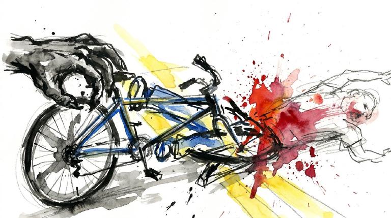
Carnage in Precinct 10 4 Contusion/Bruise (Lower leg/foot)
▸ Killed 1
▸ Severe Lacerations 1
▸ Concussion 1
▸ Fracture/Dislocation 4
▸ Internal Injury 1
▸ Whiplash 2
▸ Contusion/Bruise 11
▸ Abrasion 4
▸ Pain/Nausea 3
Crashes by Hour in Precinct 10 6 PM • 9 injuries ↑125%
Who is getting hurt? Kids 1 injuries →0% Seniors 6 injuries ↓40%
Toggle on at least one mode to see people totals.
Totals count people injured or killed. Use the mode filters above to focus the stacks.
Dangerous Bike Lanes in Precinct 10 Loading bike lane hotspots...
| Bike lane | Crashes
Cyclist injuries
Child injuries
Cyclist deaths |
|---|
What Crashes Cost Here Loading estimate...
Loading crash cost estimate...
The three blocks below show direct costs, other harm, and the total for crashes with injuries, crashes without injuries, and all crashes together.
How we calculate this
We calculate these costs using a method developed by the National Highway Traffic Safety Administration, or NHTSA. It gives one set of costs for crashes with injuries and another for crashes with no reported injuries.
Crashes with injuries cost much more because the method includes things like lost work, medical care, and long-term harm. NHTSA says crash costs include "lost productivity, medical, legal and court costs, emergency service, insurance administration, congestion, property damage, and workplace losses."
These are estimates, not bills. "Other harm" is the part of the broader estimate that goes beyond direct bills and insurance claims. It captures pain, disability, and lost quality of life.
Download the math (CSV) · Download the math (JSON) · Method and sources
Preventable Speeding 595 16+ offenders ↓66%
Repeat School-Zone Speeding Offenders
- ≥ 6: 1,601 (2026 year-to-date) • Prev: 4,309 2025 year-to-date
- ≥ 16: 595 (2026 year-to-date) • Prev: 1,774 2025 year-to-date
Pedestrian Injuries 85% by Cars and Trucks ↓26%
About this chart
We group pedestrian injuries and deaths by the vehicle type that struck them (as recorded in police reports). Use the year selector to compare the current window with the prior period.
- Trucks/Buses, SUVs/Cars, Mopeds, and Bikes reflect the broad categories we use to track vehicle harm.
- Counts include people on foot only; crashes with no injured pedestrians do not appear in this card.
Notes: Police classification can change during investigations. Small categories may have year-to-year variance.
CloseAssembly Member Deborah Glick A (100)*

District 66
- 2022-06-24 · Leadership · Streetsblog NYC · ↑ helps gradeGovernor Hochul signed a bill making school zone speed cameras run all day, every day. No more gaps. Crashes and injuries near schools drove the change. The law dropped tougher penalties, but sponsors vow to keep fighting. Streets stay dangerous. Cameras now never sleep.
- 2022-06-24 · Leadership · gothamist.com · ↑ helps gradeGovernor Hochul signed the bill. Speed cameras in New York City now operate around the clock. No more nighttime gaps. Deborah Glick backed the measure. The law aims to slow cars, protect people, and keep streets safer for everyone.
- 2022-06-07 · Leadership · Streetsblog NYC · ↑ helps gradeTraffic deaths surge while lawmakers stall. Fifty-nine killed by cars in three months. Streets favor SUVs over people. Full-time speed cameras help, but car subsidies fuel the carnage. Ryder Kessler calls for bold action: end giveaways, reclaim space, protect the vulnerable.
- 2022-06-02 · Vote · Open States · ↑ helps gradeSenate passed S 5602 to keep school zone speed cameras running longer. More eyes on reckless drivers. Lawmakers push back against speeding near kids. The vote was clear. The danger remains.
- 2022-05-31 · Vote · Open States · ↓ hurts gradeAssembly and Senate passed A 8933. The bill shields emergency vehicle operators from fines for traffic violations during medical calls. Vulnerable road users face more risk. Accountability weakens. Streets grow more dangerous.
- 2022-05-31 · Vote · Open States · ↓ hurts gradeAssembly and Senate passed A 8933. The bill shields emergency vehicle operators from fines for traffic violations during medical calls. Vulnerable road users face more risk. Accountability weakens. Streets grow more dangerous.
- 2022-05-25 · Vote · Open States · ↑ helps gradeSenate passed S 5602 to keep school zone speed cameras running longer. More eyes on reckless drivers. Lawmakers push back against speeding near kids. The vote was clear. The danger remains.
- 2022-05-23 · Leadership · Streetsblog NYC · ↑ helps gradeAlbany passed a bill letting New York City run speed cameras all day, every day. Lawmakers cut tougher penalties for repeat offenders. Advocates called the final bill a win, but mourned lost safety measures. Vulnerable road users remain exposed to reckless drivers.
- 2023-12-31 · Leadership · NYC Council – Legistar · ↑ helps gradeCouncil calls for state action on Sammy’s Law and SAFE Streets Act. The bills would let New York City lower speed limits and give crash victims new rights. Lawmakers push to curb deadly driving and protect those on foot and bike.
- 2023-12-31 · Leadership · NYC Council – Legistar · ↑ helps gradeCouncil calls for scramble crosswalks at schools. Kids cross in all directions. Cars stop. Fewer deadly conflicts. NYPD cut crossing guards. Streets stay dangerous. Council pushes Albany for action.
- 2023-09-28 · Leadership · NYC Council – Legistar · ↑ helps gradeCouncil calls for scramble crosswalks at schools. Kids cross in all directions. Cars stop. Fewer deadly conflicts. NYPD cut crossing guards. Streets stay dangerous. Council pushes Albany for action.
- 2023-09-28 · Leadership · NYC Council – Legistar · ↑ helps gradeCouncil calls for scramble crosswalks at schools. Kids cross in all directions. Cars stop. Fewer deadly conflicts. NYPD cut crossing guards. Streets stay dangerous. Council pushes Albany for action.
- 2023-04-11 · Leadership · NYC Council – Legistar · ↑ helps gradeCouncil calls for state action on Sammy’s Law and SAFE Streets Act. The bills would let New York City lower speed limits and give crash victims new rights. Lawmakers push to curb deadly driving and protect those on foot and bike.
- 2023-04-11 · Leadership · NYC Council – Legistar · ↑ helps gradeCouncil calls for state action on Sammy’s Law and SAFE Streets Act. The bills would let New York City lower speed limits and give crash victims new rights. Lawmakers push to curb deadly driving and protect those on foot and bike.
- 2023-04-11 · Leadership · NYC Council – Legistar · ↑ helps gradeCouncil calls for state action on Sammy’s Law and SAFE Streets Act. Lower speed limits. Rights for crash victims. Safe passing for cyclists. Complete streets. Filed, but the fight for safer roads presses on.
- 2023-02-13 · Vote · Open States · ↑ helps gradeAssembly and Senate passed A 602. The bill sets state funding rules for federally assisted and municipal complete street projects. Lawmakers moved fast. Streets shaped by budgets, not safety.
- 2024-08-22 · Leadership · nypost.com · ↑ helps gradeState Sen. Brad Hoylman-Sigal stands firm. He says New York needs congestion pricing. The governor paused the $15 toll. Lawmakers debate lower fees and exemptions. The MTA’s future hangs in the balance. Vulnerable road users wait for action. Streets stay dangerous.
- 2024-06-07 · Leadership · Streetsblog NYC · ↑ helps gradeCharles Komanoff, veteran traffic reformer, pressed Assembly Member Deborah Glick to oppose payroll tax hikes and defend congestion pricing. He invoked decades of lost lives—pedestrians, cyclists—arguing congestion pricing cuts danger and keeps streets fair. He called tax hikes regressive, congestion pricing just.
- 2024-06-07 · Vote · Open States · ↑ helps gradeAssembly passes A 7652. Schenectady gets school speed cameras. Law aims to slow drivers near kids. Cameras expire in 2028. Vote split. Streets may get safer for children on foot.
- 2024-06-07 · Vote · Open States · ↑ helps gradeAssembly passes A 7652. Schenectady gets school speed cameras. Law aims to slow drivers near kids. Cameras expire in 2028. Vote split. Streets may get safer for children on foot.
- 2024-04-18 · Vote · Open States · ↑ helps gradeGlick votes yes on transportation budget bill with no safety impact.
- 2024-04-18 · Vote · Open States · ↑ helps gradeGlick votes yes on transportation budget bill with no safety impact.
- 2024-04-02 · Vote · Open States · ↑ helps gradeGlick votes yes to require recall checks before used car sales.
- 2024-03-14 · Sponsor · Open States · ↑ helps gradeAssembly bill A 9462 would hike fines for drivers caught speeding by cameras more than once. The aim is clear: hit repeat offenders in the wallet. Glick and Simone sponsor. No safety analyst review yet.
- 2025-06-30 · Leadership · AMNY · ↑ helps gradeGovernor Hochul signed S.8344/A.8787, extending NYC’s school zone speed camera program to 2030. Cameras stay. Streets watch. Danger lingers for kids crossing. Fewer drivers speed. Fewer crashes. Lives spared.
- 2025-06-25 · Leadership · Streetsblog NYC · ↑ helps gradeAlbany stalled. Lawmakers dragged their feet. No new laws for safer streets. Pedestrians and cyclists left exposed. The car stays king. The status quo kills. Vulnerable New Yorkers pay the price.
- 2025-06-17 · Vote · Open States · ↑ helps gradeSenate passes S 8344. School speed zone rules in New York City get extended. Lawmakers make technical fixes. The bill keeps pressure on drivers near schools. Streets stay a little safer for kids.
- 2025-06-16 · Vote · Open States · ↓ hurts gradeSenate passed S 7785. The bill carves out large Mitchell-Lama housing from bus traffic rules. Lawmakers voted yes. The carve-out weakens enforcement. Streets grow less safe for people on foot and bike.
- 2025-05-07 · Vote · Open States · ↑ helps gradeGlick votes yes on transportation budget bill with no safety impact.
- 2025-05-07 · Vote · Open States · ↑ helps gradeGlick votes yes on transportation budget bill with no safety impact.
- 2025-04-16 · Sponsor · Open States · ↓ hurts gradeAssembly bill A 7997 lets speed cameras catch drivers hiding or altering plates. It extends camera use in school zones. Lawmakers push to close loopholes that shield reckless drivers from accountability.
- 2025-01-16 · Sponsor · Open States · ↑ helps gradeAssembly bill A 2299 targets reckless drivers. Eleven points or six camera tickets in a year triggers forced speed control tech. Lawmakers move to curb repeat speeders. Streets demand fewer deadly risks.
- 2026-01-30 · Sponsor · Open StatesGlick co-sponsors climate and community investment act, with no safety impact.
- 2026-01-29 · Leadership · NYC Council – Legistar · ↑ helps gradeRes 0050-2026 was sent to committee. It presses Albany to allow school-hour scramble crosswalks. A full pedestrian phase would stop turning cars while kids cross.
- 2026-01-29 · Leadership · NYC Council – Legistar · ↑ helps gradeRes 0050-2026 was sent to committee. It presses Albany to allow school-hour scramble crosswalks. A full pedestrian phase would stop turning cars while kids cross.
- 2026-01-29 · Leadership · NYC Council – Legistar · ↑ helps gradeRes 0050-2026 urges Albany to allow school-hour scramble crosswalks. It targets intersections, where most pedestrian deaths and injuries happen. It aims to stop turning cars from cutting through student crossings.
853 Broadway Suite 2007, New York, NY 10003
Room 621, Legislative Office Building, Albany, NY 12248
Council Member Erik Bottcher —

District 3
224 West 30th St, Suite 1206, New York, NY 10001
212-564-7757
250 Broadway, Suite 1785, New York, NY 10007
212-788-6979
State Senator Brad Hoylman-Sigal —
District 47
322 8th Ave. Suite 1700, New York, NY 10001
Room 310, Legislative Office Building, Albany, NY 12247
Other Geographies See nearby areas
▸ Other Geographies
Precinct 10 Police Precinct 10 sits in Manhattan.
It contains Manhattan CB 4, Chelsea-Hudson Yards.
▸ See also
